Northwestern Middlesex County Northwestern Northumberland County Southeastern Hanover County Northwestern James City County King and Queen County Northwestern Charles City County Richmond County New Kent County Southeastern Westmoreland County Southeastern Henrico County King William County Southeastern Essex County
Northwestern Lancaster County
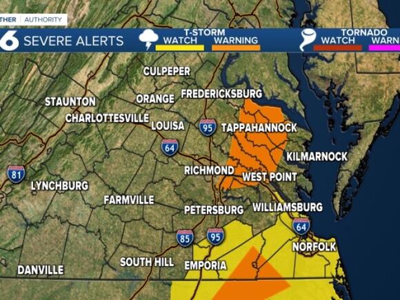
Rain will continue moving into eastern Virginia. There is a squall line of heavier rain and thunder that has the potential to produce wind gusts over 60 mph and possibly an isolated tornado.
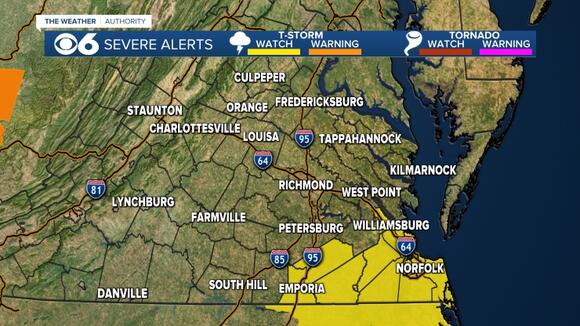
There will be a lull in the rain around midday. A cold front could cause a shower or thunderstorm this afternoon.
A severe thunderstorm watch is in effect for Greensville and Sussex counties until 3 p.m.
Regardless of thunderstorms, it will be extremely windy today.
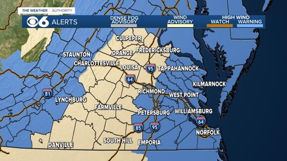
Current wind alerts:
- High wind warning for the metro and eastern Virginia. Wind gusts of 40 to 60 mph possible.
- Wind advisory north and west of Richmond. Wind gusts up to 45 mph possible.
- High wind warning in far western Virginia. Wind gusts 45 to 65 mph possible.
Very strong wind gusts could bring some trees down today due to the saturated soils. This may result in power outages.
Skies will clear later this afternoon. Highs will warm into the 50s and 60s today. A few 70s are possible in far southeastern Virginia.
Flood warnings are in effect for the James, Nottoway, Meherrin and Appomattox rivers. More information on current levels, flood stages, and forecast stages can be found here .
Tonight will be breezy and colder. Lows will be in the 20s to lower 30s.
Monday will be mostly sunny with highs in the low to mid 40s. Lows at night will be in the 20s.
Tuesday will be partly cloudy with highs in the mid 40s.
We continue to watch a potential major winter storm for Wednesday into Wednesday night.
The energy for this system is still in the eastern Pacific, so many of the details on the track and possible snowfall amounts will change a lot in the coming days. There does appear to be a high chance of significant snowfall across a good chunk of central Virginia.
The computer models continue to vary on whether we will see any wintry mix, and how far north that would extend. Many times, as the storms approach our area, they shift a bit northwestward, which causes a changeover to a mix and cuts down on snow accumulation.
However, the latest computer models from overnight into this morning are suggesting this event may stay mainly snow. We will have further updates the next few days as the storm moves into the data network in the western U.S., which will put more useful information into the computer models. Precision on exact amounts will come into better focus.
It will stay cold into next weekend.
Stay With CBS 6, The Weather Authority.
STORM TRACKING LINKS :
📱 Download the new and improved CBS 6 Weather App for iPhone and Android .

Depend on the CBS 6 Weather Authority to Keep You Ahead of the Storm.
